OLD PROSPECT

The Old Prospect and Maguires workings are located on or adjacent to a series of sub parallel NNW and NW trending second order structural splays located to the west of the regional Dalgaranga-Big Bell Shear corridor. Old Prospect mineralisation extends over at least 650 metres of strike and is located within a 5km long zone of mineralisation extending from Cap Lamp to Middle Bore that is open along strike to the north and south.

Historic exploration was completed by BHP, Posgold and OZZ consisting of RAB, Reverse Circulation (RC) and Diamond drilling. Significant intercepts include:

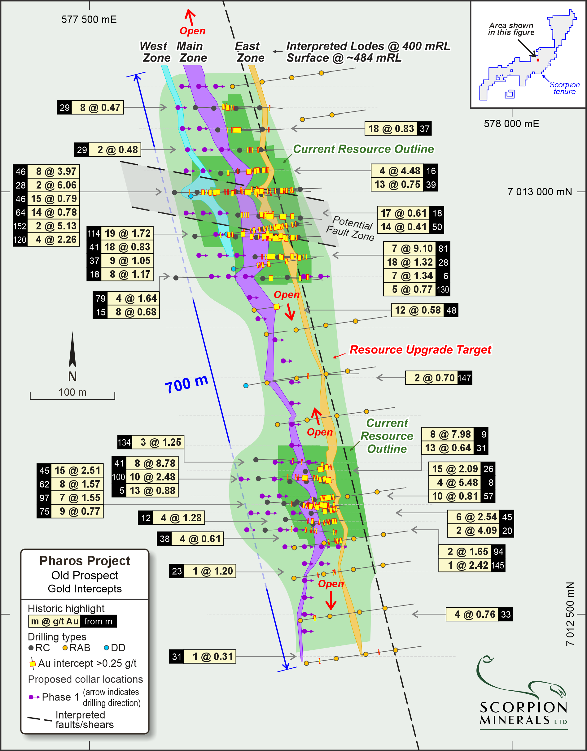
  • 8m @ 8.78 g/t Au from 41m, including 2m @ 30.8 (BWRC006)
  • 8m @ 7.98 g/t Au from 9m, including 1m @ 32.4 and 1m @ 19.9 (BWRC020)
  • 7m @ 9.10 g/t Au from 81m, including 1m @ 56.1 (21MRRC011)
  • 15m @ 2.51 g/t Au from 45m (21MRRC003)
  • 19m @ 1.72 g/t Au from 114m, including 1m @ 21.1 (JBD001)
  • 8m @ 3.97 g/t Au from 46m, including 1m @ 20.2 (21MRRC032)
  • 15m @ 2.09 g/t Au from 26m, including 1m @ 13.8 (BWRC004)
  • 10m @ 2.48 g/t Au from 100m (21MRRC039)
  • 18m @ 1.32 g/t Au from 28m (21MRRC011)
  • 4m @ 5.48 g/t Au from 8m, including 1m @ 12.8 (BWRC005)
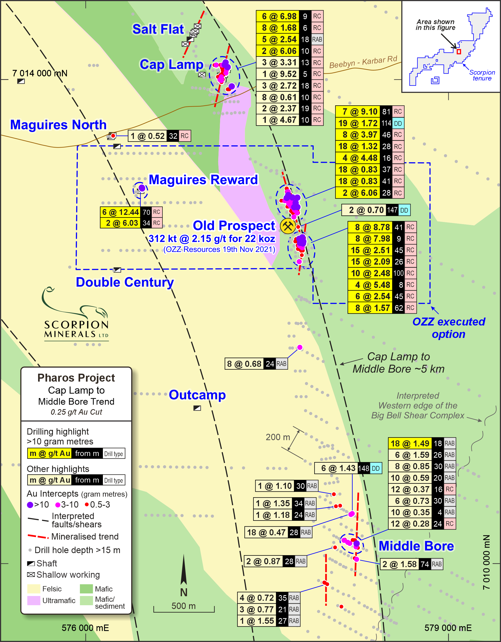
Cap Lamp to Middle Bore Overview highlighting Old Prospect RC drilling results within 5km long structural corridor
Old Prospect Exploration Target Mineralised Zones and significant intercepts plan
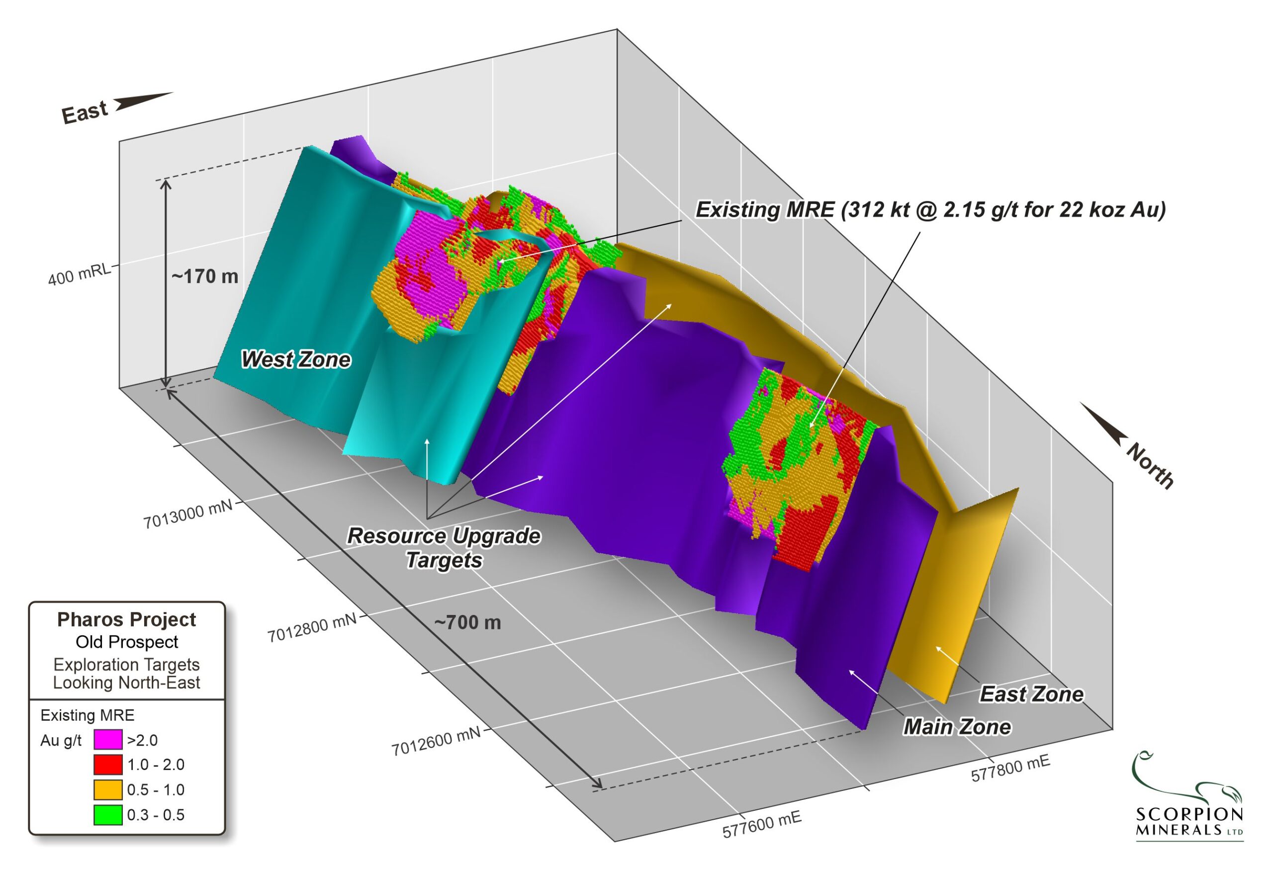
Isometric View of Old Prospect looking Northeast

Planned Activities

Exploration work will recommence across Scorpion’s tenements early in the January quarter, the key areas of focus will include:

  • Infill and extension RC drilling at Old Prospect
  • Definition of an Exploration Target
  • Mining studies and an application to convert Old Prospect tenements to a mining lease
  • Diamond drilling to test the mineralisation down plunge at depth and collect material for geotechnical/metallurgical assessment/test work.
  • Follow-up RC drilling of selected regional targets – approx. 1500 metres
  • Detailed (1:5000 scale) geological mapping
    50m line spaced
  • Airborne Magnetic Survey
  • Detailed lithostructural Interpretation utilising detailed mapping and air magnetics